Location: Fairbanks, AK
Trip Mileage: 12,516
Car Mileage: 222,807
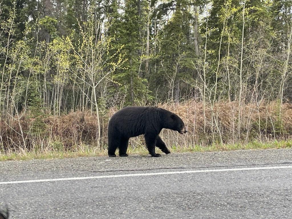
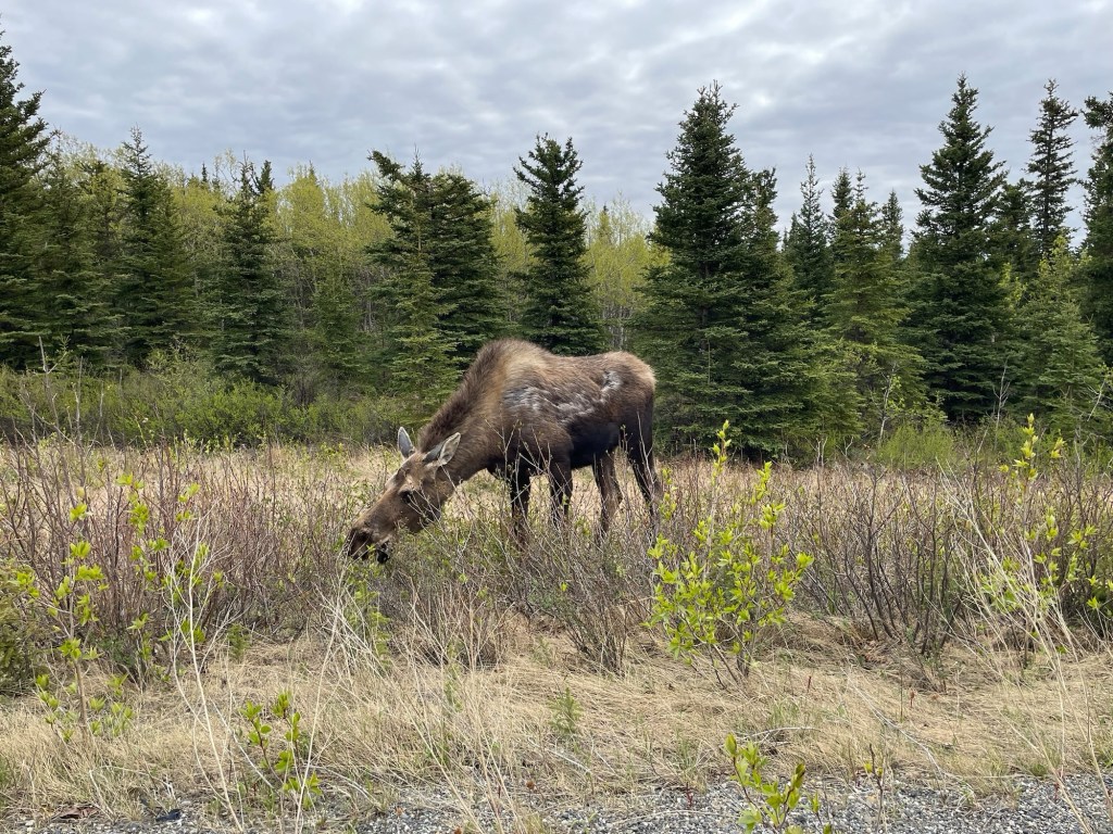
I had two main hopes when I was rolling out of my parent’s driveway two months ago: to see a bear and for my car to make it through the trip. Finally, after being in bear country for the last 8,000 miles, I saw one. And another. And another. A grand total of 19 black bears and a single grizzly bear. Sprinkle on a few moose, and the wildlife rating in Canada was a massive success.
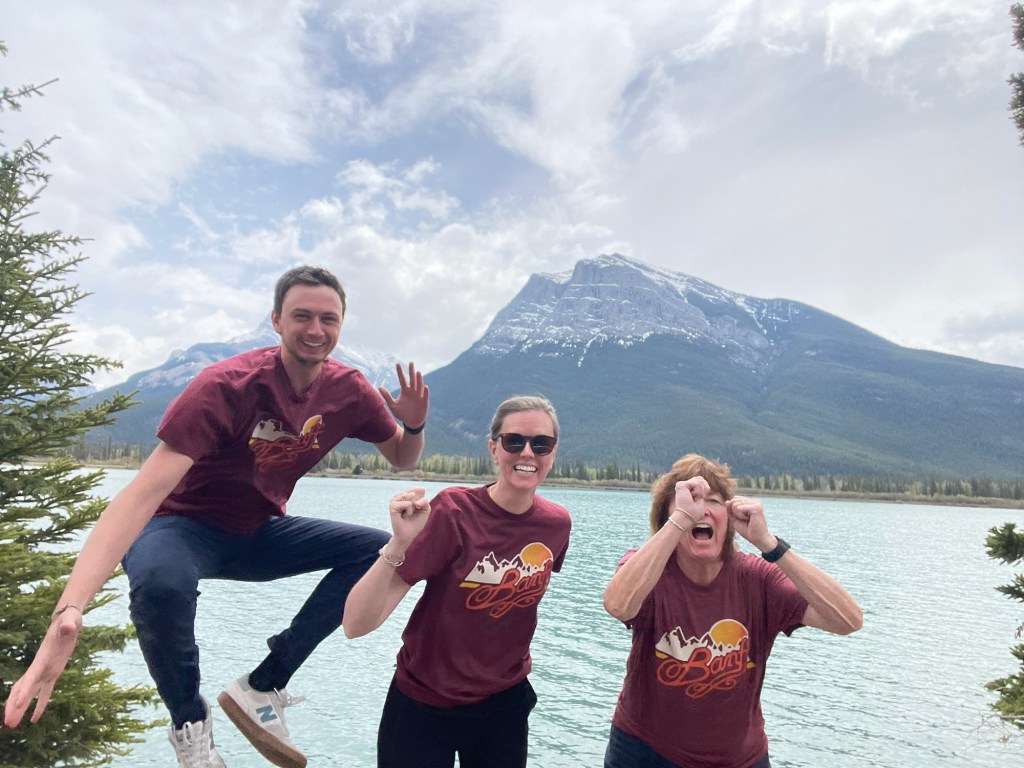
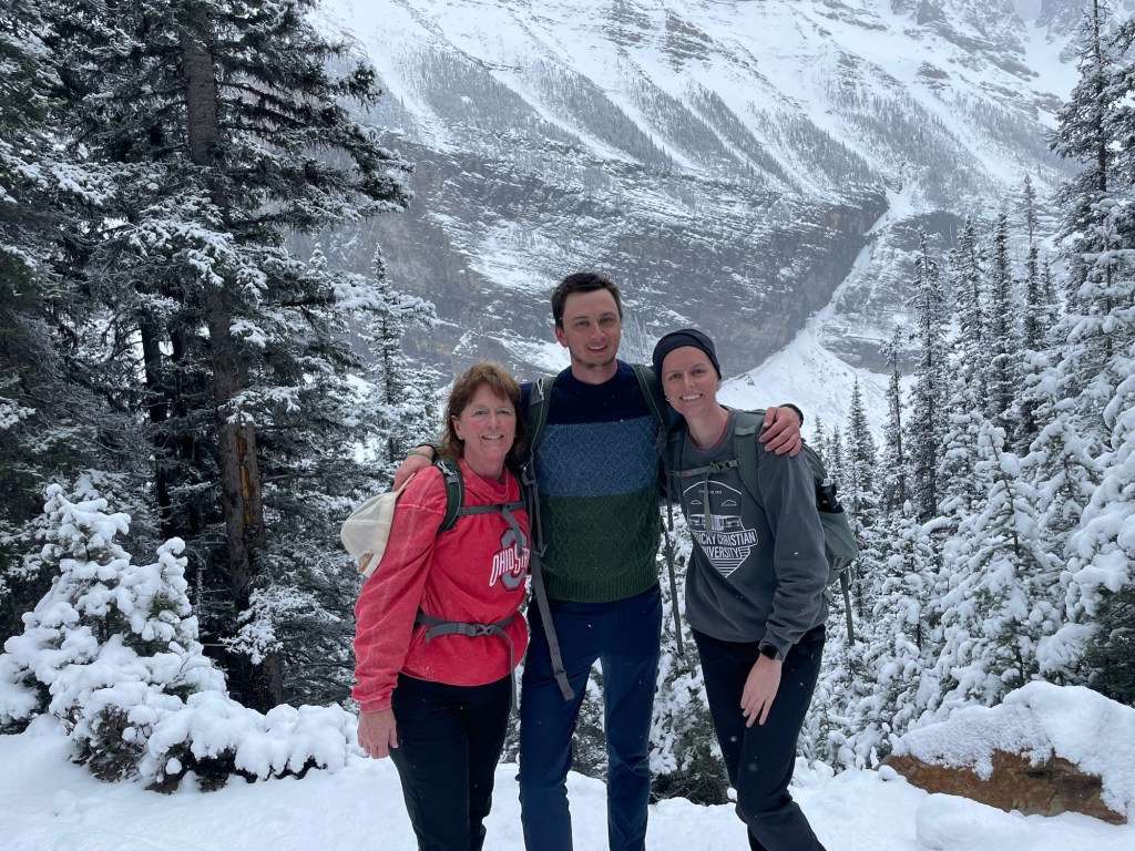
My mom and sister flew into Calgary to explore Banff National Park with me. Banff has a reputation for the pristine beauty of its glacial lakes. Lake Louise is the most famous. We were very anxious to get to Louise and made it priority number one to ensure swarms of tourist didn’t take all the spots. A 6 am alarm and reserved shuttle tickets all to get this stunning view of a mostly frozen lake.
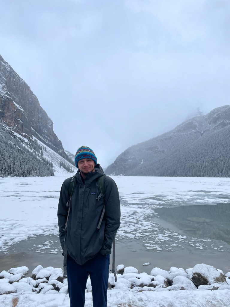
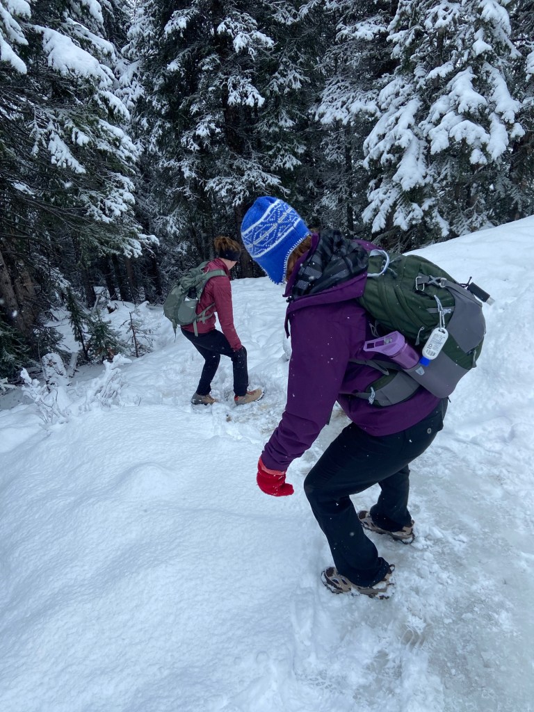
Bummer. Definitely could have afforded to sleep in and give the ice a couple more hours to thaw. Not only was the lake frozen, but the surrounding trails were still covered in snow, and we are talking FEET of snow for most of it. The trail was about one foot wide and any errant step meant you were in snow up to your knee (at least). We decided to try and hike the surrounding mountains anyway: without crampons (shoe spikes) and without hiking poles.

I think the feat of hiking four miles up hill with simple hiking boots in huge bluffs of snow sounds pretty impressive, which makes it tempting to leave out the reality that my sixty-year-old mother did it as well.

This hike likely would have blended into the archives of hike memories had it not been for the unique conditions though, and it probably does stand out as the best hike of my trip.
I will probably have to stop back by Lake Louise on my return trip to see what all the fuss is about.
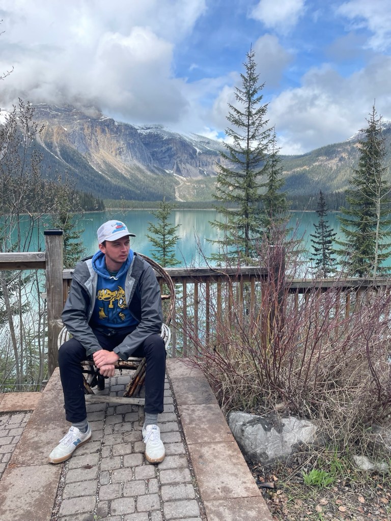
Yoho National Park is only a short drive from Banff, so we took an afternoon and drove there. Here we saw Emerald Lake. I expected this to be frozen just like Louise, but thankfully I was wrong. I’d consider Yoho a must visit when in the Banff area.
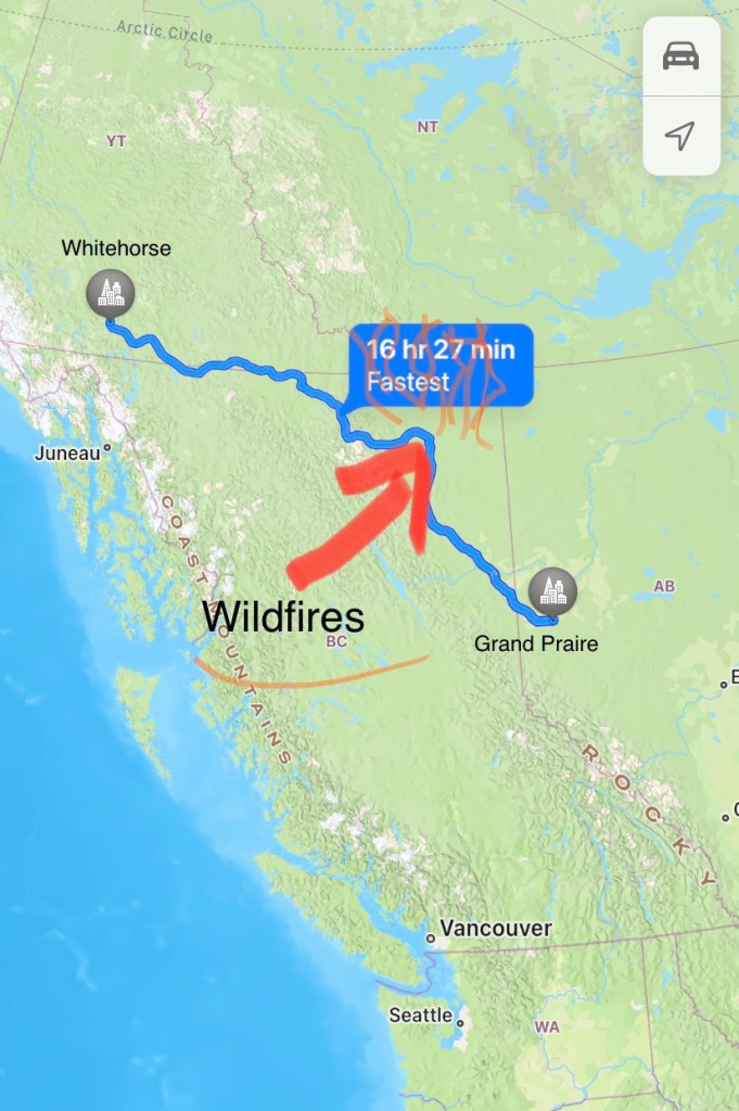
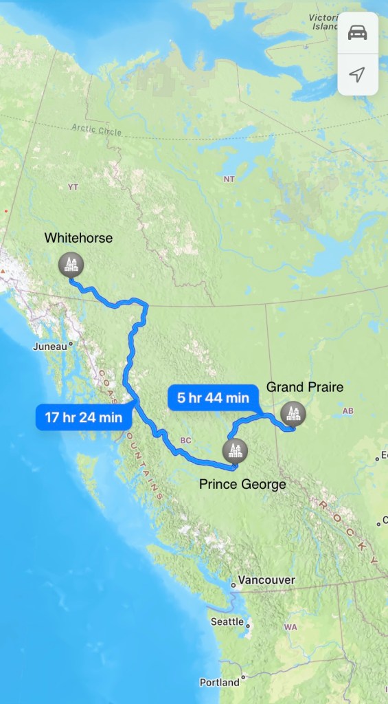
I dropped Bethany off at the airport, and with my mom in the passenger seat we embarked for Alaska. This should have been a 33-hour drive, with the only must-see spot being Jasper National Park. When I crossed the Canada/Idaho border, I was told the Alaskan Highway (the quickest route) was the way I needed to take to avoid forest fires. The wind must have changed because when we got to milepost 0 of the highway, we were told that we would need to take an 8-hour detour due to forest fire road closures. What little I had planned for the route was now scrapped. We were still able to visit Jasper NP, which is where we saw our first bear, but you can see the way the path warped with the planned route on the left and the adjusted route on the right.
After driving for 10.5 hours in a day, we were closing in on a campsite for the night when we passed a sign advertising the “Highway of Tears”. My only thought when I saw this sign was, “Glad I’m not a woman”.
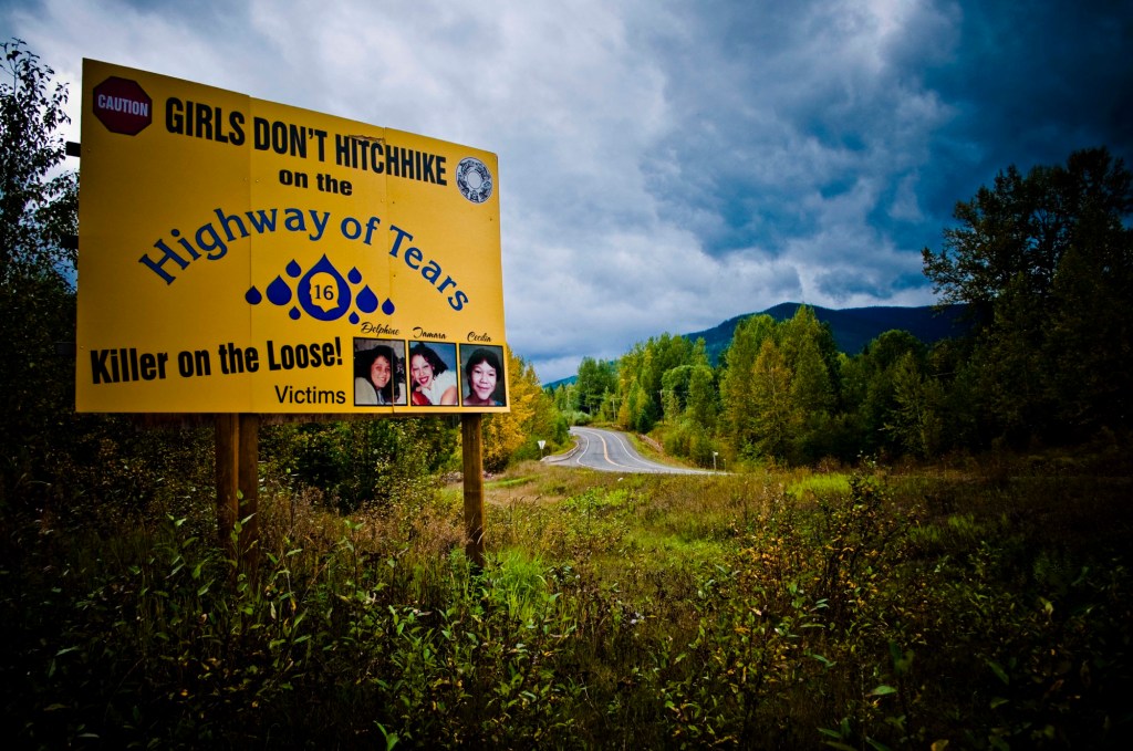
My mom, however, made the mistake of researching, and when I looked over to see Expedia open on her phone, I knew we wouldn’t be camping that night. 80+ missing and murdered women since 1970 all unsolved. “That’s really not THAT bad.” I told my mom. “It’s only 1.5 abductions a year.” At her angst, I kept driving. What’s ironic is that after another couple hours on the midnight road we pulled off to a rest area to figure out what we were doing and ended up sleeping sitting upright. Horrible night where we got a couple hours of sleep. But we were napping on THE HIGHWAY OF TEARS right beside a truck driver who had plenty of cargo space to abduct and transport my mother (I would have been fine). I started driving again at 4 am, and another 12-hour drive day meant we had made up all the lost time caused by the forest fire.
The one positive to come from the diverted route, aside from quality time with my mother (she’s reading this), was Boya Lake.
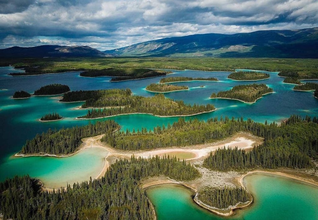

It looked like the Caribbean in the middle of Canada. We canoed on the lake and walked around one of the islands. When we came across bear prints, we got back in the canoe and rowed a little harder.
Gas was so expensive in rural Canada. I could rant on how Canada does gas too. So I will. They price it in cents per liter. Literally an impossible conversion for an American. Dollars per liter would be one thing, and I understand that with 100 cents in a dollar that it’s just a matter of moving the decimal. But that just seems like such a petty system. So I paid 219 Canadian cents for a liter of gas. Who thinks of currency in terms of the smallest unit of measurement though? Why aren’t they measuring their gas in milliliters then? How many bottles of Mountain Dew is a liter? What about Diet Mountain Dew? So many questions. They’re silly up here. Also their speed limits top out at just 68 miles an hour, so one of their “mounties” could probably chase you down and pull you over while on horseback.
Okay, apologies Canada.
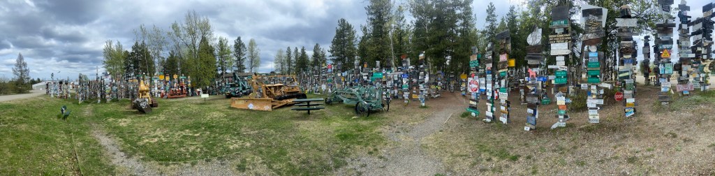
Once in the Yukon Territory, we made a couple more stops in Watson Lake, Whitehorse, and Kuale NP. Watson Lake was only worth a mention due to their sign forest. Over 100,000 signs from just about everywhere, this was a good place to stretch the legs and try to spot a sign from close to home. There were many WV license plates and a couple WVU signs that I would have liked to deface.
Whitehorse is where we spent the night. I didn’t see a town in Yukon that was winning any beauty prizes. Everything is made to withstand the winters and not to be a pretty backdrop for tourist influencers. Every car has a power cord sticking out of the front grill so they can plug in to heat up their engines in the winter. There was a sign showing the record low as -69 degrees F.
Kuale NP (on the short list for coolest sounding park names) was known for their Dall Sheep and a large Grizzly population. The Grizzly was the last realistic animal we hadn’t seen. (I’d still like to see a Mountain Lion and Polar Bear).

The drive from Kuale to Alaska is also where we saw our lone Grizzly. I actually haven’t seen any bears since arriving in Alaska, so Canada is winning on that front.

Fairbanks is much smaller than I expected. For some reason I had it in my head that it was a population of 100,000, but it is actually closer to 30,000.
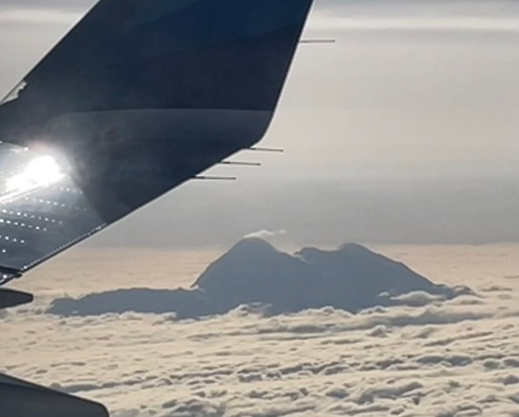
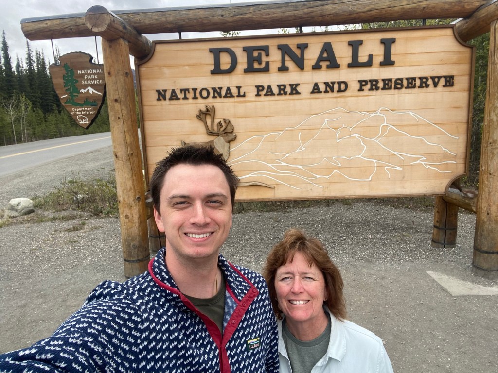
My mother and I took a day trip to get a preview of Denali before I go back next week. The peak was covered in clouds, but she was luckily able to see it above the clouds on her flight home.
My hope for wildlife has been fulfilled, which now leaves me getting my car through this trip with a motor that still runs. I have decided to go ahead this week with the portion that has loomed ahead of my Civic for the whole expedition. The Dalton Highway is the northernmost road in North America. This is the road into the Arctic Circle all the way to the Arctic Ocean. The road is 500 miles long and largely unpaved. I’ve been on forums for the last six months trying to figure out if anyone has ever completed the trek with a Civic, and all I have found is that no one has written about it. Every post about the road warns to bring multiple spare tires and to be prepared to have your windows cracked from trucks kicking up rocks. This is a road meant for semi-trucks, and local rental companies apparently will not allow you to take their cars on it.
I hope I report on this excursion in a week or so and have only a boring story to tell. I only have one spare tire, and if that comes into play in the first 200 miles, then I will probably cut my losses and turn tail. The town in the north, Deadhorse, is one of the few areas where you have a chance to see a Polar Bear outside of a zoo in the USA.
I have three weeks to cover everywhere I need to go in Alaska. If things go poorly on the Dalton Highway, then that three weeks is going to shrink significantly. If everything goes well, then I will proceed to Denali NP, Wrangell St. Elias NP, and Kenjai Fjords NP. I’ve planned ahead with an extra five gallon can of gas, and a tire puncture repair kit. There’s not much more I can do outside of buying a Jeep Rubicon.
It feels strange to be at the destination that I have planned for the past year. When I fly back to Huntington for a friend’s wedding in a few weeks it will be like I have reached the top of a mountain with the rest downhill. That is usually the fun part, but it is also the part that goes by the quickest, and I still don’t know what is waiting for me at the bottom.
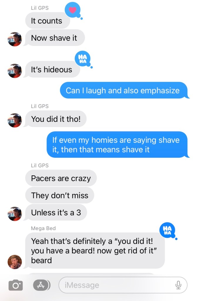
Oh, also my friends conceded that the hair on my face qualified as a beard, so to pretty much everyone’s delight and nobody’s dismay I have shaved at last.

Maybe now I trade bear sightings for interactions with humans who thought I was homeless.

Leave a comment